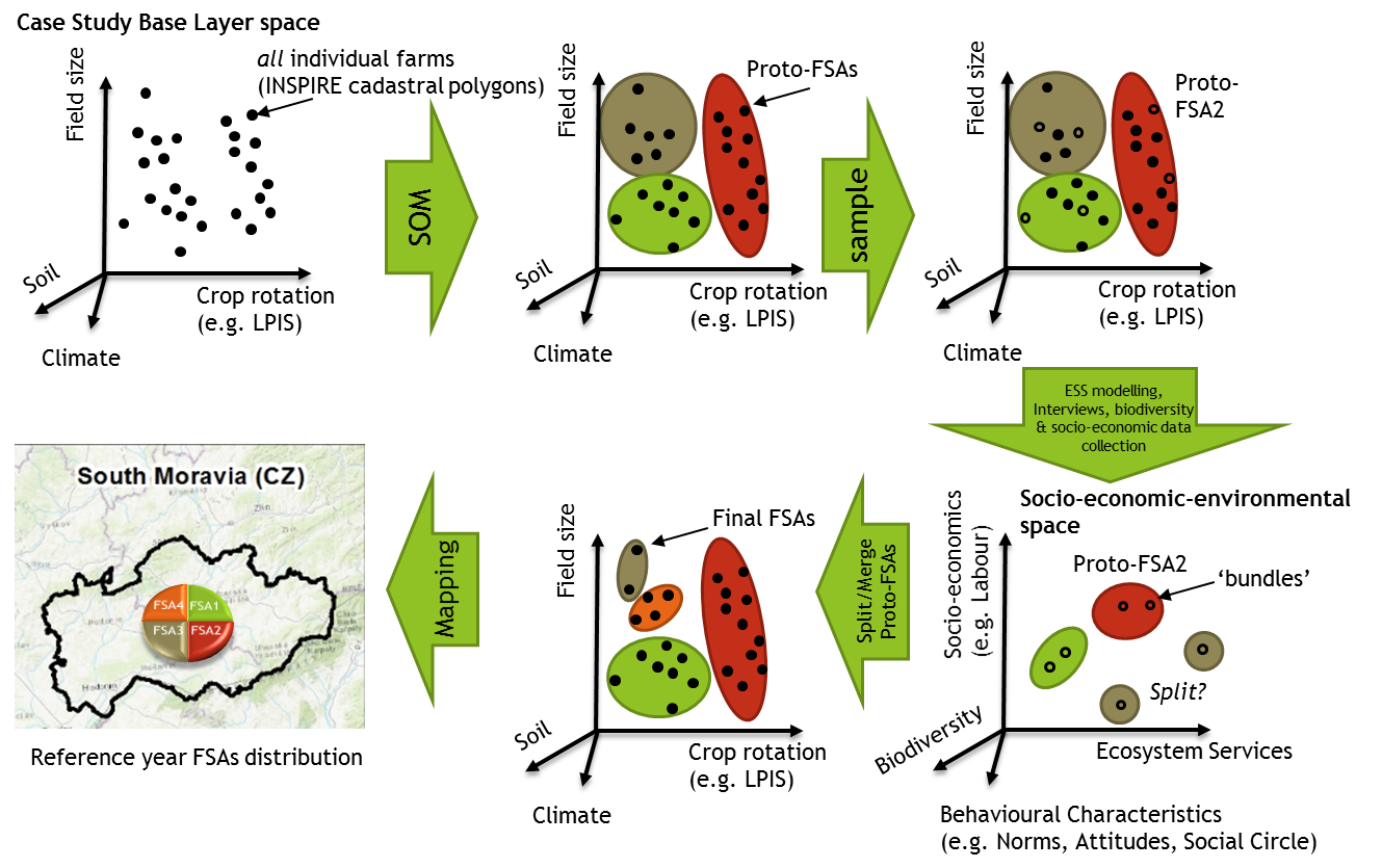
BESTMAP workflow to map FSAs, defined as having a characteristic bundle of ESS (and dis-services e.g. pollution), biodiversity, socio-economic and behavioural characteristics. Geospatial datasets (the Case Study Base Layer) will be used to approximate these FSAs (the “Proto-FSAs” clusters) in the first step; followed by interviews, field data collection and modelling to assign values on ESS, biodiversity, socio-economic aspects and behaviour for a stratified sample of proto-FSAs farms. The proto-FSAs will likely share “socio-economic-environmental” space and will be split/merged to minimize (but not eliminate) that overlap by changing the clustering in Case Study Base Layer space, defining the final FSAs and their spatial distribution.