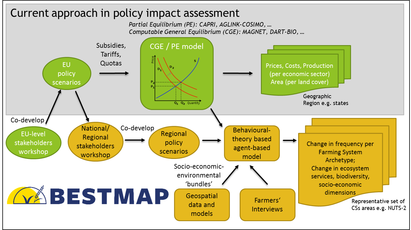
Top-level conceptual framework of BESTMAP. BESTMAP combining existing global/EU scale (green) models used by the EC, in particular Partial Equilibrium (PE) and Computable General Equilibrium (CGE) models with regional analyses (yellow) by
- formalizing engagement with stakeholders to define scenarios;
- using existing geospatial data and empirical data collection to map farming systems based on a novel concept of Farming System Archetypes (FSA) namely farms with a characteristic bundle of ESS, biodiversity, socio-economics and behavioural characteristics of decision-making agents (i.e. farmers);
- linking economic (typically global) large scale economic based PE/CGE to agent-based models;
- describing changes in FSAs’s distribution, ESS, biodiversity and socio-economics in a representative sample of case study areas.