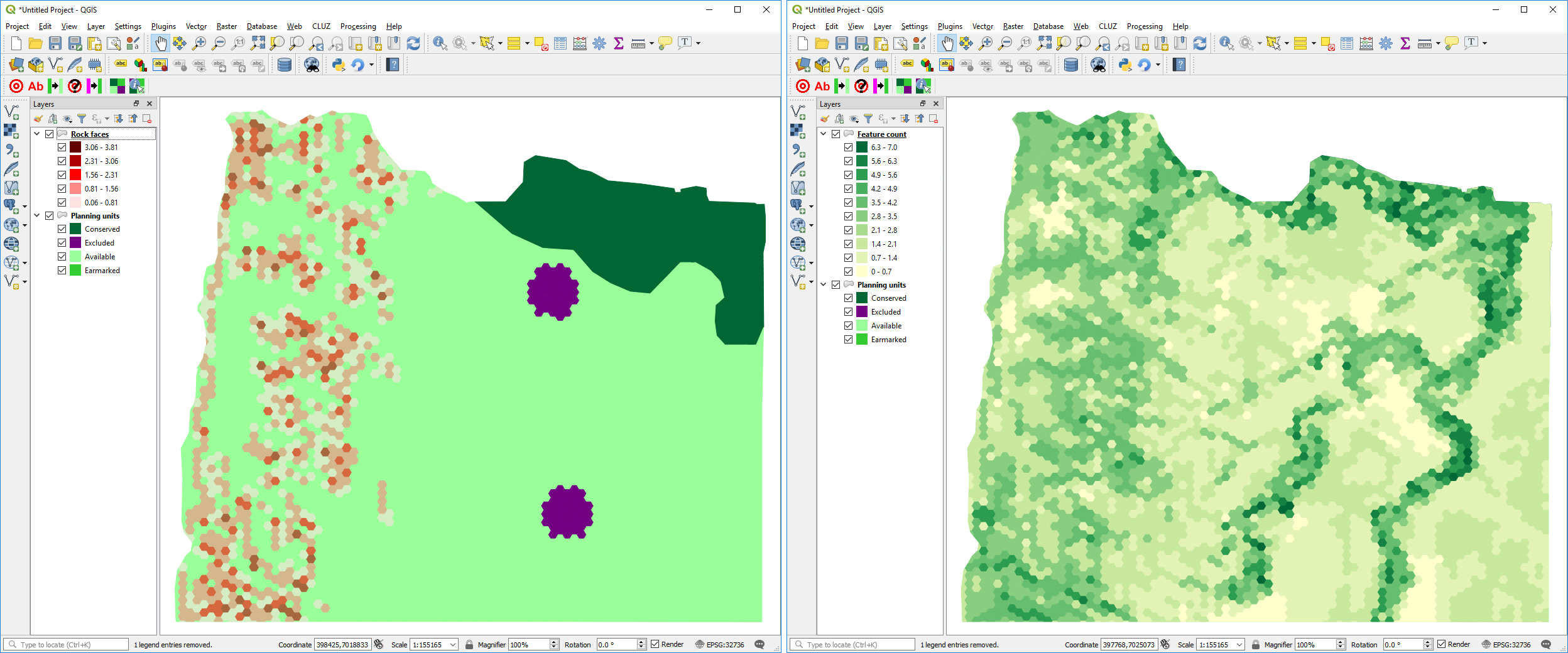
Screenshots of QGIS showing on the left, a CLUZ distribution map of one of the conservation features, and on the right a map of the number of conservation features found in each planning unit.
|
|
||
|
Screenshots of QGIS showing on the left, a CLUZ distribution map of one of the conservation features, and on the right a map of the number of conservation features found in each planning unit. |
||
| Part of: Smith R (2019) The CLUZ plugin for QGIS: designing conservation area systems and other ecological networks. Research Ideas and Outcomes 5: e33510. https://doi.org/10.3897/rio.5.e33510 |