| |
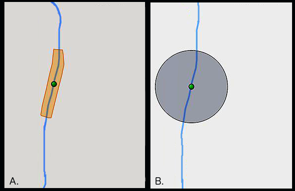
An illustrative example of the two methods of uncertainty capture when georeferencing specimens. Method A, or polygon, creates a shape around the river (in blue). Method B, or point-radius, creates a circle of uncertainty around the origin. The illustration is based on output from GeoLocate software (Rios 2018) for both polygon and point-radius.
|
|
| |
Part of: Seltmann K, Lafia S, Paul D, James S, Bloom D, Rios N, Ellis S, Farrell U, Utrup J, Yost M, Davis E, Emery R, Motz G, Kimmig J, Shirey V, Sandall E, Park D, Tyrrell C, Thackurdeen R, Collins M, O'Leary V, Prestridge H, Evelyn C, Nyberg B (2018) Georeferencing for Research Use (GRU): An integrated geospatial training paradigm for biocollections researchers and data providers. Research Ideas and Outcomes 4: e32449. https://doi.org/10.3897/rio.4.e32449
|
|