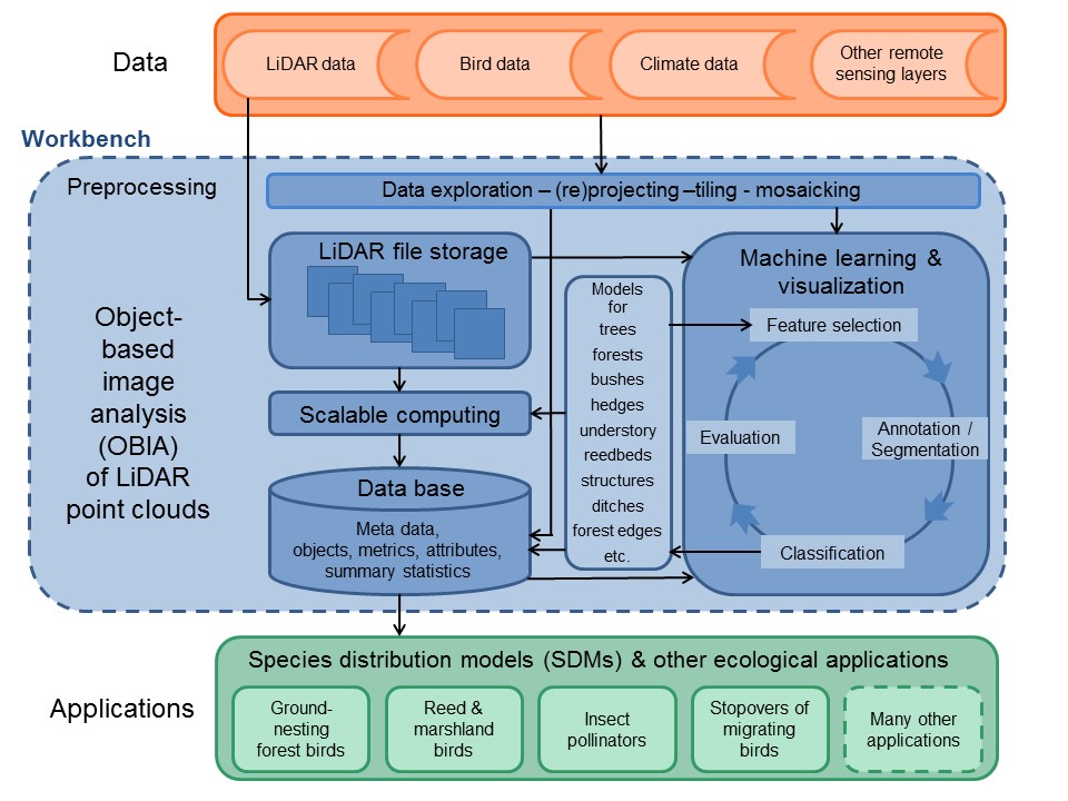
Generic workflow for object-based image analysis (OBIA) of LiDAR point clouds and proposed ecological applications. A workbench (blue) will be developed to handle the data storage, data exploration, and interactive OBIA of the massive LiDAR point clouds. Combined with datasets of bird distributions, climate, and other remote sensing layers (orange), the LiDAR data will be applied to several ecological case studies, e.g. by using species distribution modelling of birds and insect pollinators (green).