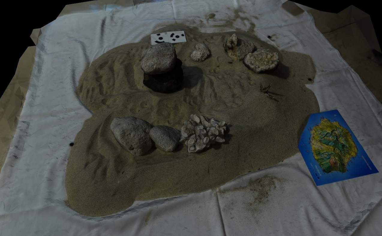
3D model of a scene rebuilt by the participant during the hands-on session of L. Van Audenhaege (n = 42 images) and displayed on Meshlab. Note the small vignettes on the upper part to automatically scale the model in Agisoft. Note also a 3D map of La Réunion topography on the lower right part of the picture.

 
  Part of: Van Audenhaege L, Mahamadaly V, Price D, Sneessens A, Cawthra HC, Delamare C, Danet V, Delsol S, Devillers R, Gazis I-Z, Urbina-Barreto I (2023) Workshop on 3D mapping of habitats and biological communities with underwater photogrammetry. Research Ideas and Outcomes 9: e115796. https://doi.org/10.3897/rio.9.e115796